

Français – عربي – ⵜⴰⵎⴰⵣⵉⵖⵜ – English
Strabo was an influential philosopher, historian and geographer in Roman Antiquity, who wrote the first universal geography. In this article, we will discover his description of North Africa.

Strabo was born around 64 BCE, in Amaseia (Amasya, North-East of modern-day Turkey). His family was from the Pontiac nobility, but romanised. In his youth, like many young people from rich families at the time, he started travelling. After his native Asia Minor, he explored Italy, Greece, the Eastern regions of the Empire, and Egypt. From there, he sailed up the Nile, all the way to Ethiopia.
He is mostly known as the author of the Geographica, a vast “universal geography” in 17 books. This work, inspired by his travels, gives an overview of all the regions of the known world at the time, with their peoples and their customs. While he draws inspiration from Greek authors like Posidonius, Polybius and Eratosthenes, he doesn’t hesitate to criticize their conclusions and complete them with his own observations. His work mostly aims to celebrate the advent of the Roman Empire and its “civilizing” influence on almost the whole world he knew. He is considered as the most prominent ancient geographer.
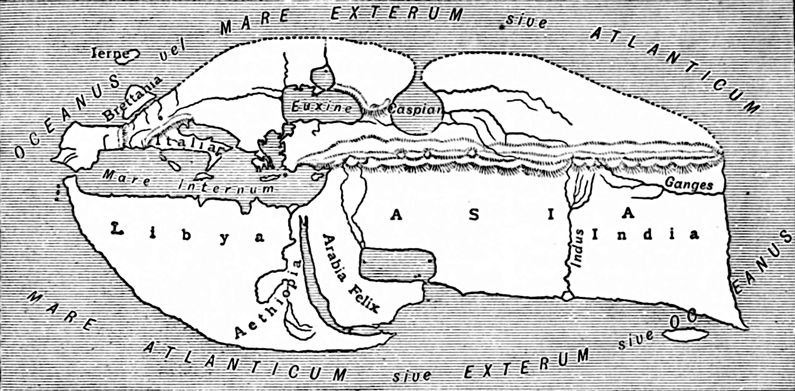
After two introductory books explaining geographical theory, the next books each describe one region of the world. Books 3-10 are on the European continent, books 11-16 on Asia, and book 17 on Africa. The last book contains three chapters: on Egypt, Ethiopia, and “Libya” – that is, all the Northern part of the continent, after Egypt. This last chapter is of interest to us here.
Strabo sees the African continent as a triangle. Only its base, the Mediterranean coastline, together with Ethiopia, is inhabited, while the inside is too hot for men to live there. Even the inhabitable part of the continent is largely desert, especially around the Syrtes and Marmarica.
Strabo starts with Mauretania, especially the region around the Columns of Hercules (Strait of Gibraltar), with the city of Lixus (Larache), then Tingis (Tangier), the “Tombs of the Seven Brothers” (Septem Fratres) – seven mounds around the Ceuta (Sebta) peninsula – and, finally, Mount Abyla (Jebel Musa). He describes Mauretania as an extremely fertile region, with giant vine, and also many wild animals, especially monkeys.
Between the Columns of Hercules and Carthage, Strabo only mentions one place he deems worth of interest: Iol, recently renamed Caesarea (Cherchell). He does however describe the Mediterranean islands of Corsica, Sardinia, Sicily, Malta, and Lampedusa. He also gives a long description of Carthage and its region.
After Carthage, he gives a detailed description of the outline of Syrtis Major and Syrtis Minor, with a list of the cities in the area. Finally, the chapter concludes on Cyrenaica and Marmarica.
Strabo continued reworking his Geographica until his death, at around 90 years of age. His mention of the recent death of King Juba II of Numidia, who died in 23 of our era (“Juba also just died and left his throne to his successor and heir Ptolemy”) indicates that he died shortly after Juba II.

1 thought on “Strabo: a Roman geographer describes North Africa”